1: Dudhkunda - Pikey Trek
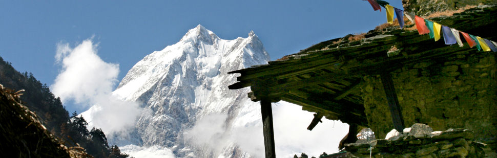
Located in the lower Everest region and situated in front of Numbur Himal, Dudhakunda is a lake which in Nepali translates literally as the Milk Pond. Every August there is an influx of devotees of Hindus and Buddhist who come to perform cleansing ritual at the lake. At other time you are unlikely to meet anyone on this rarely traveled trail. One can enjoy on this route an authentic Sherpa village and culture, rhododendron and magnolia forest.
In the mean time, Pikey Peak is another superb peak and one of the highest in the area from where you can enjoy the majestic view of the Everest Himalayan Range and other mountain ranges as well. Once you are on top of this peak, you can view spectacular sunrise/sunset and whichever direction you turn, you simply get to see breathtaking scenarios.
Itinerary in detail:
Day 01: Arrival day in Kathmandu (1400m)
Day 02: Rest (preparing documents for the trek) day in Kathmandu
Day 03: Flight to Phaplu (2469m) from Kathmandu
Day 04: Phaplu to Bhotekharka (2800m), 6/7 hrs
Day 05: Bhotekharka to Rapchha (1900m) 4/5 hrs
Day 06: Rapchha Rest day (visit Rapcha village to see Khaling Rai Culture)
Day 07: Rapchha to Nunthala (2330m), 3/4 hrs
Day 08: Nunthala to Taksindu La (2930m), 3/4 hrs
Day 09: Taksindu La to Sarkari Pati (3503m), 3/4 hrs
Day 10: Sarkaripati to Saharsabeni (3835m), 4/5 hrs
Day 11: Saharsabeni to Dudhakunda (5100m) and back to Saharsabeni, 6/7 hrs
Day 12: Saharsabeni to Kumagangdo (2830m), 5/6 hrs
Day 13: Kumagangdo to Thupten Chholing Gumba (3000m), 3 hrs
Day 14: Thupten Chholing (visit Junbesi village) to Lamajura La (3530m), 6/7 hrs
Day 15: Lamajura La to Pikey Base Camp (3640m), 4/5 hrs
Day 16: Pikey summit (4065m), back to Pikey Base Camp, 5/6 hrs
Day 17: Pikey to Loding (2800m), 5/6 hrs
Day 18: Loding to Phaplu (2469m), 3/4 hrs
Day 19: Flight to Kathmandu from Phaplu
Day 20: Rest (shopping, sightseeing) Day in Kathmandu
Day 21: Drive to Tribhuvan International Airport to fly back to home country.
Trekking in Nepal , Everest Region
2: Everest Kalapathar Trek
There is no denying that Nepals Himalayas have drawn adventurers, climbers and cultural enthusiasts for hundreds of years now. Hospitable village people, rugged terrain, majestic mountains etc. are some of the attractions that have made the travelers to visit Nepal time and again. Nowhere else in the world will you find the physical, cultural and religious diversity that Nepal holds. Nepal offers a unique kaleidoscope of South Asian culture, combined with the worlds most spectacular mountains, warm and hospitable people to make your visit a lifetime experience. In this trek, we take you through the land of Sherpas, mighty Himalayas, green valleys and unique settlements.
Commencing from Lukla, we trek through the Sherpas capital of Namche Bazaar. A day is spent here for acclimatization or to be familiar with the atmosphere of this bustling village before heading on up through Tengboche, Pheriche, Lobuche village and Gorak Shep. It is the jumping off point for the climb up to Kala Pattar (5.545 m) for spectacular views of
Mt. Everest, and the walk to the Everest Base Camp.
This moderate trek will lead to Gokyo Lake and over the Cho La at 5,430m making a circuit of Tawache (6,367m) and Cholatse (6,440m). Emerging into the Khumbu valley above Lobuche the trail continues up to Kalapatthar and then back to Lukla via Tengboche and Namche Bazaar. The small settlement of Gokyo (4750m) lies on the banks of the third lake. We can see the four peaks above 8000m of Cho Oyu (8,201m), Makalu (8,463m), Lhotse (8,516m) and Everest (8,848m) exposing above Gokyo. In addition to this, we will have a look at the tremendous ice ridge between Cho You and Gyachung (7922m). Besides, there is also an option to explore Cho La, a 5420m-high pass into Khumbu and Gokyo Ri
Itinerary in detail:
Day 01: Arrival at Kathmandu (1320m)
Day 02: Rest (preparing trekking documents) day in Kathmandu
Day 03: Kathmandu to Lukla (2886m) and then to Phakding (2640m)
Day 04: Phakding to Namche Bazzar (3440m)
Day 05: Acclimatization at Namche Bazzar
Day 06: Namche Bazaar to Tyangboche (3867m)
Day 07: Tyangboche to Dingboche (4260m)
Day 08: Acclimatization at Dingboche (4260m)
Day 09: Dingboche (4350m.) to Chhukung (4730m)
Day 10: Chhukung to Chhukung Ri (5546m) and then to Lobuche (4930m)
Day 11: Lobuche (4900m) to Gorakshep (5180m)
Day 12: Gorakshep to Kala Patthar (5545m) and then to Pheriche (4243m)
Day 13: Pheriche to Phortse (3750m)
Day 14: Phortse (3750m) to Khumjung (3790m)
Day 15: Khumjung to Thame (3800m)
Day 16: Thame to Monjo (2835m)
Day 17: Monjo to Lukla (2800m)
Day 18: Lukla to Kathmandu by plane
Day 19: Rest (shopping) day in Kathmandu
Day 20: Drive to Tribhuvan International Airport to fly back to home country
Trekking in Nepal , Everest Region
3: Tashi Lapcha Trek
The Tashi Lapcha trekking is one of the harder trekking trails in Nepal. At one point after crossing Tashi Lapcha Pass and before arriving Thame village, everybody involved in the trekking has to cross a slope with the use of rope. This route requires a high elevation crossing so one has to be physically apt for this environment. This can be a fun trek for mountaineers. This is a total camping trekking.
We can do this trek from two other different routes too. If you are interested, please contact us and we will be happy to provide you the other two routes.
Itinerary in detail:
Day 01: Arrival in Kathmandu
Day 02: Rest (document preparation for the trek) day in Kathmandu
Day 03: Drive from Kathmandu to Dolakha (1660m)
Day 04: Dolakha to Singati Bazzar (950m)
Day 05: Singati Bazar to Chilingkha (1924m)
Day 06: Chilingkha to Gonggar (1440m)
Day 07: Gonggar to Simigaon (2000m)
Day 08: Simigaon to Ramding (3500m)
Day 09: Rmding to Nagaon (4180m)
Day 10: Acclimatization day at Nagaon
Day 11: Nagaon to Kabug (4551m)
Day 12: Kabug to Tesi Lapcha base camp (5882m)
Day 13: Tesi Lapch Pass to Thyangbo (4230m)
Day 14: Thyanbo to Namche (3440m)
Day 15: Rest day in Namche
Day 16: Namche to Phakding (3792m)
Day 17: Phakding to Lukla (2840m)
Day 18: Lukla to Kathmandu by plane
Day 19: Rest (shopping, sightseeing) day in Kathmandu
Day 20: Drive to Tribhuvan International Airport to fly back to home country.
Trekking in Nepal
4: Kanchenjunga Region
Among other highlights, Milke Danda is one of the important highlights of this trek. Milke Danda is located in the far east of Nepal. This is a long and high forest ridge that divides Arun and Tamur valley in the eastern Nepal. We start trek from Tumlingtar and while trekking from here onwards, we get to view Makalu to the west and Kanchenjunga to the east. The region is densely vegetated with rare alpine flora and the beautiful rhododendron forest. It is renowned for having the highest diversity of Nepalese Rhododendron species (29 out of 32 species reported from Nepal) in Nepal. April/May is considered the best time to trek in this area.
Itinerary in detail:
Day 01: Arrival in Kathmandu
Day 02: Rest (preparing trekking documents) day in Kathmandu
Day 03: Fly to Bhadrapur; spend the night at a local lodge
Day 04: Fly or drive to Taplejung (Suketar)
Day 05: Trek to Lalikharka
Day 06: Trek to Kadebhanjung
Day 07: Trek to Mamangkhe
Day 08: Trek to Yamphuding
Day 09: Trek to Sherpagaun
Day 10: Trek to Torontan
Day 11: Trek to Tsedam
Day 12: Acclimatization day at Tsedam
Day 13: Trek to Ramche
Day 14: Trek to Oktang, Yalungkhang, return to Ramche and camp there
Day 15: Trek to Manibhuk
Day 16: Trek to Gunsa
Day 17: Acclimatization at Gunsa
Day 18: Trek to Khangbachen
Day 19: Trek to Lonak
Day 20: Trek to Pangpema Base camp
Day 21: Excursion day (Base camp or Doma RI), camp at Pangpema Base Camp
Day 22: Trek to Khangbachen
Day 23: Trek to Gunsa
Day 24: Trek to Gyapla
Day 25: Trek to Amjilasa
Day 26: Trek to Sekathum
Day 27: Trek to Chhiruwa
Day 28: Trek to Furumba
Day 29: Trek to Suketar
Day 30: Fly back to Kathmandu
Day 31: Rest (shopping, sightseeing) day in Kathmandu
Day 32: Drive to TIA (Tribhuvan International Airport) to fly back to home country
Optional:
Day 30: Drive to Birtamod, spend the night at a local lodge
Day 31: Drive to Kathmandu
Day 32: Rest (shopping, sightseeing) day in Kathmandu
Day 33: Drive to TIA (Tribhuvan International Airport) to fly back.
Trekking in Nepal ,Langtang Region
5: Langtang - Gosaikund Trek
The Langtang Gosaikund trek offers an opportunity for the trekkers and adventurers to rediscover the Himalayan passes, pristine valley and diverse ethno- culture he found in 1949. We stay at local teahouse on this Langtang Gosaikunda trekking. Though easily accessible from Kathamandu it remains relatively unspoiled and less developed trekking in Nepal. Several great days of pleasant Langtang Gosainkund trekking through dense forest and traditional ethnic settlements takes you to the holy Gosaikunda Lake and alpine yak pasture of Kyangin gompa, while the mountain views are genuinely inspiring. Over the years this Gosainkunda has become one of the sacred pilgrimage sites for Shamans, the traditional witch doctors, as well as many Hindu and Buddhist devotees. A cross over the Laurebina Pass at an altitude of 4620 meter with an excellent view into Tibet is simply breathtaking
Itinerary in detail:
Day 01: Arrival in Kathmandu
Day 02: Sightseeing, shopping, documents preparing for trek day in Kathmandu
Day 03: Kathmandu to Dhunche(2150m), 8 hrs drive
Day 04: Trek to Syabru Village (2200m), 5-6 hrs
Day 05: Trek to Sing Gompa (3584m), 5-6 hrs
Day 06: Trek to Gosai Kunda (4381m), 6-7 hrs
Day 07: Trek to Ghopte (3430m), 5-6 hrs
Day 08: Trek to Melamchi village (2550m), 6-7 hrs
Day 09: Trek to Tarkey Ghyang (2550m), 5-6 hrs
Day 10: Trek to Dhukpa Kharka (4080m), 6-7 hrs
Day 11: Trek to Ganjala Tall (4650m), 6-7 hrs
Day 12: Trek to Ganjala Pass (5350m) and Nyengang Kharka (4430m), 7-8 hrs
Day 13: Trek to Kyanjing Gompa (3800m), 5-6 hrs
Day 14: Trek to Langshisa kharka (4200m), 5-6 hrs
Day 15: Rest Day in Langshisakharka, visit the area and go for hiking
Day 16: Trek to Yala High Camp, Piyung (5125m), 4-5 hrs
Day 17: Trek to Yala Peak (5500m) and get back, 7-8 hrs
Day 18: Trek to high camp to Kyanjing Gompa, 5-6 hrs
Day 19: Trek to Lama Hotel (2480m), 5-6 hrs
Day 20: Trek to Shyabru Bensi (1460m), 5-6 hrs
Day 21: Drive to Kathmandu from Syabrubesi, 7-8 hrs
Day 22: Drive to Tribhuvan Intentional Airport and fly back to home country.
Trekking in Nepal, Annapurna Region
6: Ghorepani Trek
The Ghorepani and Poon Hill Trek starts and ends in Pokhara, a colourful foray into the Annapurna region. The trail winds through patchwork valleys, dense mossy forests and past icy waterfalls where you can stop to cool your face. Around every corner is a tantalizing glimpse of the high mountains, whole horizons of which will be revealed to you as you reach the high points of your trek. Trekking in the Annapurna foothills to the view point at Poon Hill offering you unobstructed,mountain.views.
An easy trek in the spectacular mountain scenery through charming villages inhabited by the Gurungs, Magars dense rhododendron forests full of birds and deep sub-tropical valleys, all set below the Annapurnas with the picturesque Peak of Machhapuchhare (Fish Tail Peak) dominating the skyline. This trekking is not recommended during,the,raining,season.
Itinerary in detail:
Day 01: Arrival in Kathmandu
Day 02: Sightseeing, shopping and document preparation day in Kathmandu
Day 03: Drive to Pokhara (800m), 6-7 hrs drive
Day 04: Drive (3-4 hrs) to Nayapul (1010m) and trek to Tikhedunga (1570m), 3-4 hrs
Day 05: Trek to Ghorepani (2840m), 5-6 hrs
Day 06: Hike up to Poon Hill (3210m) and trek to Tadapani (2610m), 5-6 hrs
Day 07: Trek to Ghandruk (1940m), 4-5 hrs
Day 08: Trek to Nayapul (1010m) and drive to Pokhara.
Day 09: Visit Pokhara
Day 10: Drive back to Kathmandu, 6-7 hrs
Day 11: Shopping, sightseeing day in Kathmandu
Day 12: Drive to Tribhuvan International Airport to fly back to your home country.
Trekking in Nepal, Annapurna Region
7: Annapurna Sanctuary/Circuit Trek
There are few places in the world with abundance of such a splendid variety of natural beauty as the Annapurna region. It is rare combination of long array of snow capped peaks, crystal clear lakes, and turbulent rivers with deep gorges, hot springs and picturesque villages inhabited by simple and friendly local people. This three-week trek takes you in to the heart of the high mountains.
It is said that Annapurna Circuit/Round is one of the most famous trekking routes in the world. The trek around the Annapurna Massif is one of the finest in the Himalayas and is regularly described as one of the top ten treks in the world. It is observed that about 64% of the trekkers who come every year to Nepal for trekking trek to Annapurna regions which makes this region the most trekked region of Nepal.
Annapurna region offers a great variety of beautiful landscapes, nature & culture of the central Himalayan area of Nepal with the best & splendid Himalayan panorama of Mt. Annapurna 2,3,4. Mt. Fishtail,(6997m)Mt.Nilgiri,(7061m)Mt.HimChuli,(68650m)Mt. Dhaulagiri,(8172m) Mt. Gangapurna(7454m) Mt. Tilicho(7134m) and several other mid western Himalayan range mountains of Nepal . From the heights of the pass we descend to Muktinath and its sacred Buddhist and Hindu Shrines. Further south, the contrast of the Nepal Himalaya become even more apparent, as high windswept passes are replaced by forests, or mandarin and banana groves. Finally we trek out of the gorges and look back to the peaks of the Annapurna and Dhaulagiri, before traversing the forest ridges down to Pokhara.
Itinerary in detail:
Day 01: Arrival in Kathmandu
Day 02: Rest Day (document preparation day for the trek) in Kathmandu
Day 03: Drive to Besi Sahar (820m), from Kathmandu, 5-6 hrs drive
Day 04: Trek to Bahundanda (1320m), 5-6 hrs
Day 05: Trek to Chamje (1440m), 6-7 hrs
Day 06: Trek to Bagarchhap (2160m), 5-6 hrs
Day 07: Trek to Chame (2675m), 6-7 hrs
Day 08: Trek to Pisang (3210m), 5-6hrs
Day 09: Trek to Manang (3500m), 5-6 hrs
Day 10: Acclimatization day at Manang
Day 11: Trek to Yak Kharka, (4000m), 4-5 hrs
Day 12: Trek to Thorung Phedi (4550m), 5-6 hrs
Day 13: Pass Thorung La (5416m) and descend down to Muktinath (3800m), 7-8 hrs
Day 14: Trek to Marpha (2670m), 5-6 hrs
Day 15: Trek to Kalopani (2410m), 6-7 hrs
Day 16: Trek to Tatopani (1190m), 5-6 hrs
Day 17: Trek to Gorepani (2850m) and Poonhill to Hile, 6-7 hrs
Day 18: Trek to Hile (1400m) 4-5 hrs
Day 19: Trek to Nayapul (1010m), 5-6 hrs
Day 20: Drive to Pokhara (800m), 5-6 hrs
Day 21: Sightseeing in Pokhara
Day 22: Drive back to Kathmandu (1345m), 6-7 hrs drive
Day 23: Rest, sightseeing and shopping day in Kathmandu
Day 24: Drive to Tribhuvan International Airport and fly back to home country.
Trekking in Nepal, Annapurna Region
9: Naar Phu Vally Trek
Explore the hidden valley of Nar Phu and trek along the "off the beaten path" crossing through challenging high passes of Kang La and Thorung La. A fantastic journey in a wild and unexplored area located north of Annapurna: the Nar Phu Valley. This trek is perfect for travelers who want to discover the Annapurna circuit as well as explore an untouched valley. A rough and wild trek, this trek takes you to the exotic Nar Phu valley that lies in the remote corner of the Annapurna region. Opened to visitors only in the year 2003, the Nar Phu valley remains untouched by modernity. The inhabitants, who roughly comprises of about 350 Nepalese Tibetans, have retained their age old practices. Most of them are engaged in yak herding and farming.
This trek also offers fantastic views of the Annapurna massif, Lamjung Himal, Machhapuchhre Himal, Manaslu Himal, Dhaulagiri range and Tilicho peak. As the trekking route is frequented by few trekkers, you can look ahead for a 'just the mountains, nature & us' experience.
Itinerary in detail:
1: Arrival day in Kathmandu
2: Rest (Document preparation day), sightseeing or shopping day
3: Drive to Besisahar then to Bhulbule, 6-7hrs
4: Trek to Ghermuphat, 5-6hrs trek
5: Trek to Dharapani (1860m), 6-7hrs
6: Trek to Koto (2600m), 6-7hrs
7: Trek to Methang (3560m), 6-7hrs
8: Trek to Kyang (3820m), 5-6hrs
9: Trek to Phu (4080m), 4-5hrs (lunch/camp)
10: Acclimatization day in Phu (we visit Tibetan type monasteries & local villages),
hike 500m-600m up from Phu village
11: Trek to Naar Phedi (Mahendra Pul [3490m]: pul means bridge,
visit Monasteries & local village & some chorten, 6-7hrs
12: Trek to Naar (4110m), Lunch /camp, 4-5hrs
13: Rest/excursion day in Naar (we will acclimatize, visit monasteries & chorten).
We can view Pisang peak (6091m) from here
14: Trek to Kang La Phedi (4530m), 5-6hrs
15: Trek to Nawal (3660m) via Kang La Pass (5306m) from where we get
to view Annapurna 2, 3& 4, as well as Tukuche Peak
16: Trek to Manang (3540m), 5-6hrs, and visit Bhraka Monastery which is about 900 year
old (oldest monastery in Manang region). View Annapurna 2, 3, 4, Gangapurna,Tilicho,
Khangsar & Pisang Peak and other peaks from Manag village
17: Acclimatization day, go to see Ice Falls & Gangapurna Lake
18: Trek to Tilicho Base Camp (4150m) via Khangsar Village (3540m), 5-6hrs
19: Trek to Tilicho High Camp (4920m) via Tilicho Lake
20: Trek to Yak/Chauri Kharka (4500m) via Mesokanta La Pass (5121m), 8-9hrs
21: Trek to Jomsom (2720m), 6-7hrs
22: Flight to Pokhara, sightseeing in the afternoon
23: Drive to Kathmandu, 6-7hrs
24: Drive to Tribhuvan International Airport and fly back to home country.
Trekking in Nepal, Manaslu Region
10:Tsum Valley Trek
The Tsum Valley is a sacred Himalayan pilgrimage valley situated in a trans-Himalayan region of Gorkha, Nepal. The Tsum Valley's acquaintance with Tibet, natural beauty and its pristine culture make this trekking unique. Tsum comes from the Tibetan work 'Tsombo', which means vivid. Against the majestic backdrop of the Ganesh Himal, Sringi Himal and Baudha Himal ranges, this serene Himalayan valley is rich in ancient art, culture, and religion. The local people are mostly of Tibetan origin and speak a unique dialect. Trails are strewn with artistic chortens and lined with mani walls made of thousands of stone slabs carved with deities and prayers. The Tsum valley has a long history of Buddhism. The Buddhist saint Milarepa is believed to have meditated in the caves of these mountains. Traditionally Tsum valley was a culturally distinct geographical area called 'Tsum Tso Chuksum', which means thirteen provinces ruled as a single territory. The ancient remains of the Tsum Kingdom are still visible today. Due to its remoteness and inaccessibility, this sacred valley and its people have been bypassed by mainstream development for centuries. As a result, the unique culture of this valley has remained intact.
Itinerary in detail:
Day 01: Arrival day in Kathmandu
Day 02: Document preparing for the trek, sightseeing, shopping day in Kathmandu
Day 03: From Kathmandu drive to Arughat Bazaar, 8-9 hrs
Day 04: Arughat to Soti Khola, 6-7 hrs
Day 05: Soti Khola to Machha Khola, 6-7 hrs
Day 06: Machha Khola to Doban, 6-7 hrs
Day 07: Doban to Philim, 6-7 hrs
Day 08: Philim to Chumling,Lower Tsum, 6-7 hrs
Day 09: Chumling to Chhekambar, Upper Tsum, 5-6 hrs
Day 10: Chhekambar to Nile/Chhule, visit Milarepa Piren Phu Cave on the way, 6-7 hrs
Day 11: Nile/Chhule to Mu Gompa (3700m), visit Dhephyudonma Gompa (4060m), 4-5 hrs
Day 12: Excursion day
Day 13: Mu Gompa to Rachen Gompa, 5-6 hrs
Day 14: Rachen Gompa to Dumje, 6-7 hrs
Day 15: Dumje to Philim,cross Ripchet, 6-7 hrs
Day 16: Philim to Tatopani, 6-7 hrs
Day 17: Soti Khola to Arughat Bazar, 6-7 hrs
Day 18: Arughat Bazar to Kathmandu by bus, 8-9 hrs
Day 19: Rest day (if you wish to stay one more day in Kathmandu),
or departure to home country.
Trekking in Nepal,
11. Manaslu Region
Highlights of Manaslu Larkya-la Pass Trek:
The smaller Himalayan passes topped by the high Larkey La (5106m) and Kang La (5320 m) passes along the path.Manaslu and Nar-Phu culture, tradition, religion, and lifestyle in the Himalayas Spectacular view of Manaslu, Dhaulagiri, Annapurna and the surrounding small and important mountainous regions.Rare wildlife and vegetation, highlighting the lower Himalayas and subtropical climate regions.
Stunning Buddhist monasteries with spectacular architecture and art.
Wizardry sunrise and sunset views of the beautiful scenery of the Himalayas.
Genuine trek experience on the lesser trails discovering hill and mountain villages, culture and terraced agricultural lands of the Manaslu and Nar Phu areas.
Getting to the Manaslu Region
This fairly long trek starts from the peaceful settlement of Arughat and extends to many of the best passes in the himalayan region. Manaslu Circuit Larke La Pass 5106m and Nar Phu Valley Kang La Pass 5320M. Snow-capped mountains view from the road. And especially from the peak of these passes, there's one thing to keep in mind forever. The Significant Peaks, such as Annapurna, Manaslu, Dhaulagiri, Macchapucchre, Ganesh Himal, and the sub-ranges surrounding us. Absolute Manaslu trek is a heaven for any photographer to study Gurung, Nubri, and other traditional art of living.
Manaslu is the eight highest mountain in the world with a height of 8,163 meters above the sea level. Manaslu is locally known as Kutang. The beauty of Manaslu is very popular all around the world. The Nepal Government created the Manaslu Conservation Area (MCA) with an area of 1,663 Sq. Km in December 1998. The Manalsu Region is located in the northern part of Gorkha district, bordering with the Tibetan plateau of the People’s Republic of China to northeast, Annapurna Conservation Area to the west and the mid part of Gorkha district to the south. The Manalsu Region elevation ranges from the lower altitude of 1400 m. to 8,163 m above sea level. The seven VDCs (Districts) of MCA are culturally divided into three valleys namely Nubri, Kutang and Tsum. Nubri, which means "The Western Mountains" in the Tibetan dialect, includes the section of Budi Gandaki valley west of Namrung. Kutang is the region along the Budi Gandaki valley between Namrung and Dyang including parts of Prok and Bihi VDCs. The area along the Shyar Khola valley in the eastern part of the conservation area, including Chumchet and Chhekampar VDCs is known as Tsum.
Itinerary in detail:
Day01: Arrival in Kathmandu
Namaste and welcome to Nepal. Alpine Excursion Treks and expedition's representative welcome you warmly at the Tribhuwan International Airport and transfer to the hotel. You take rest and enjoy your meal in the evening. Overnight at Hotel.
Day 02: Sightseeing, shopping and document preparation day in Kathmandu
After the breakfast, you set out for the sightseeing trip in the Kathmandu valley. Our expert tour guide shows you the UNESCO world heritage sites, which include Pashupatinath (the Hindu temple), Boudhanath (Buddhist stupa), Swayambhunath (Buddhist stupa and temple). Then, return back to the hotel. Overnight at Hotel.
Day 03: Drive to MachhaKhola (900m), 9-10 hours
We set off early today for Machhakhola directly. During the drive, we enjoy views of the Nepalese countryside along with the mountain sceneries. We will be driving on a paved road from Kathmandu to Dhading Bensi, district headquarter of Dhading (1050m)but the drive from Dhanding Bensi toMachhakhola will be on a rough road. Upon reaching Machhakhola Via Arughat,Sotikhola, a major town in the region. Overnight at Lodge/Tent.
Day 04: Trek to Jagat (1340m), 6-7 hours
The narrow trail makes some minor ups and downs and eventually crosses the Thado Khola and reaching Khorlabesi. After a few more ascends and descends we come across a small Hotspring in Tatopani. From the hot spring, we climb over another ridge, then cross the Budhi Gandaki on a suspension bridge. At this place, we climb on a wide, well-crafted staircase, then across a landslide and over a ridge to Dobhan. Upon crossing a suspension bridge over the Yaru Khola, we climb the stone stairs and then drop to the river and again climb more stone stairs to Thado Bharyang. Crossing the west bank of the Budhi Gandaki, we climb over a ridge, trek along the river where very unique bridge which is attached to the hill which we need to cross and then climb towards the village of Jagat. Overnight at Lodge/Tent.
Day 05: Trek to Dyang (1850m), 5-6 hours
We begin today’s trek by climbing over a rocky ridge to Salleri, and then trek down to Sirdibas/Philim. The valley widens a bit as the trail continues up to Ghatte Khola. We further continue walking upstream to a long suspension bridge in Philim, a large Gurung village. The trail turns north just above the lowest house in the village and stays on a fairly level trail as it crosses millet fields to EkleBhatti. The route now enters a steep. At this point, we trek down to the grassy land slopes, cross the Budhi Gandaki, then trek along the west bank for a while, then cross to the east bank and then back again. As we continue through the trail the valley widens and we pass through bamboo forests to the Dyang Khola. Upon crossing the Khola(river), we reach the small village of Dyang. Overnight at Lodge/Tent.
Day 06: Trek to Namrung (2550m), 6-7 hours After a hot breakfast, we cross the Budhi Gandaki and climb to Rana (1910m). From the bridge, we climb a bit to join a trail from Bhi, then move west up the Budhi Gandaki valley. The trail also passes through Pine forests and Maniwall where we turn towards a corner that follows to Ghap. We further cross the Budi Gandaki several times today and come across several Gompas during the trail. The trail follows the river upstream through a dense forest. After crossing the river at an impressive spot where it thunders down a narrow gorge, the forest becomes less dense and the trail is fine again. The pleasant walk continues and after a last steep climb we reach Namrung. Overnight at Lodge/Tent.
Day 07: Trek to Lho (3180), 4-5 Hours
After a very good sleep at night early morning we wake with hot tea and take hot breakfast, after this, we start trek for today as well, after a little trek we cross the wooden bridge then we climb gradually and pass through forests and reach Shyo Village, a fine village with many chortens and barley terraces. During the trail we see very stunning views of Shring ji and Ganesh Himal I (7429 m) and from the village one can also see Mt. Himal Chuli (7893 m), Manaslu (8156 m) in the south. The trail drops and crosses the side valley of Simnang Himal with Ganesh Himal always close by. Finally we reach to our destination for the day Lho. Overnight at Lodge/Tent.
Day 08: Trek to Samagoaun (3500m), 5-6 Hours
Again another beautiful for the trek starts here, when we leave Lho village, we climb a little bit where we found a gate for the Lho Monastery then we immediately trek down to river side around 100 m. After then we again cross wooden bridge and we climb up to Syala (3520 m.) Village around 2 hours. In Shayla village we will be surrounded by high mountains like Mt. Himal Chuli (7893 m), and Peak 29 (Ngadi Chuli) 7871 m. to the left, Manaslu (8156 m) and large glaciers straight ahead, and other snow summits to the right, and at the far end stands Ganesh Himal I (7429 m). Today’s journey ends in Samagaon. Overnight at Lodge/Tent.
Day 09: Trek to Samdo (3780m), 4-5 hours
Today, we descend to the Budhi Gandaki River, that has turned north and follow it to a bridge over a side stream. The trail to the left leads to the Manaslu Base camp. The Larkya la Trail passes several mani walls as the valley begins to widen. It is an easy trail on a shelf above the river passing the juniper forests of Kermo Kharka. We drop off the shelf, cross the Budhi Gandaki on a wDay 14: Trek to Dharapani and Drive to Syange /Besisaharooden bridge and climb steeply onto a promontory between two branches of the river. After river we climb up and where we found first chorten of Samdo village then we found another maniwall after this we found Samdo. Overnight at Lodge/Tent.
Day 10: Acclimatization and excursion day (Go up to Tibet border)
This is another day set aside for proper acclimatization. There are two options for us today. The option that we highly recommend is a hike, up the valley directly at the back of the Samdo village. This hike will take us to one of the trade passes to Tibet for excellent views of Mt. Manaslu (8156 m) along with other Himalayan ranges including Simrang, Hiunchuli (6441 m), Ngadi (7871 m), Larkye Peak (6249 m), Cheo Himal ( 6820 m) and possibly Kang Guru behind the pass. On route to these viewpoints we pass many seasonal herding settlements called doksas and sight some beautiful mountain birds like the Lophophorus (the national bird of Nepal), Lammergeyer and Himalayan Griffin soaring high above us. Another option for today could be a trip to the Gya La ('large pass') to the north of Samdo, a more frequently used trading route to Tibet. But, this is a rather longer hike (whole day) and hence could be a little tiring. Overnight at Lodge/Tent.
Day 11: Trek to Dharmasala (4800m), 4-5 hours
With the beautiful morning and hot breakfast again our day starts, we continue our walk down the edge, cross the wooden bridge over Budi Gandaki again and begin walking upward. Upon crossing two streams and viewing the Larkya Glacier we go around the valley of the Salka Khola and climb up again to the stone guest house (4450 m), which is not a lodge but a kind of shelter called Dharmshala, also known as Larke Phedi. The short walk today also leaves plenty of time for acclimatization and relaxing in the afternoon. Overnight at Lodge/Tent.
Day 12: Cross Larkya La pass (5106m) and trek to Bhimthang (3590m), 8-9 hours
Today a final challenging of the trek, we wake early morning around 4 o'clock and take breakfast whatever we get and we start our trek at 5 o'clock. We climb about 2 hours then we reach a valley on the north side of the Larkya Glaciers from where we can enjoy great views of Cho Danda and Larkya Peak. Finally, we walk across moraines of the glacier, making a gradual ascent which becomes steeper only in the last section of the pass. From the pass, there are outstanding views of Himlung Himal, Cheo Himal, Kangguru and the huge Annapurna II (7937 m). It is a longer day than usual to Bimtang. Overnight at Lodge/Tent.
Day 13: Trek to Tilje (3900m), 5-6 hours
Hopefully yesterday's tiring body will come up in a shape today. Another trek will start again. From a ridge at Bimthang, we can enjoy great views of Mt. Manaslu (8,156 m), Lamjung Himal (6,983 m), Himlung Himal (7,126 m) and Cheo Himal
(6820 m). We descend further and cross a high pasture (Sangure Kharka) followed by a bridge over Dudh Khola. We walk through rhododendron forest and follow a trail through a narrow valley until we reach the highest cultivated land of the valley at Karche, 2785 meters. We pass across fields before making a steep climb over a ridge. The trail comes off the ridge in a big, sweeping arc to the river bank at 2580m. A short distance beyond is the village of Gho. Due to yesterday's tiredness we might take an overnight rest at Gho but better lodges are available at Tilje, so Alpine Excursion Treks recommends to at Tilije. Overnight at Lodge/Tent.
Day 14: Trek to Dharapani and Drive to Syange /Besisahar
Day 15: Drive back to Kathmandu
Day 16: Rest (Shhopping day) in Kathmandu
Day 17: Final Departure in your homeland
Trekking Difficulty of this trek:
It's among the longest trekking in Nepal. The trek begins from subtropical to tundra climatic zones while passing through six different climatic zones. It also extends from 715 meters to 5218 meters and passes through the valley of Buddi Gandaki, which surrounds Mount Manaslu. Of course, due to its gradual altitude, it is difficult to walk in thin air and to cover 177 kilometers in the distance.
The Manaslu Trek is great for people who have a good physical health and are eager to stroll at high altitudes. Note that hiking in Manaslu is moderate to strenuous. However, elderly people can also finish this trek if they take the necessary
acclimatization.
Lodging and food during the trek:
Accommodation is in guesthouses (often called teahouses) along the way. Rooms have two single beds and usually a small window. Toilet facilities are most often shared rather than en-suite bathrooms on the Manaslu Trek. They can be inside the main house or in the outhouse. It may be a western style toilet or a squat. Things tend to become more basic at higher altitudes. There's also a dining room where food is prepared, so it's a perfect spot to get to know your fellow trekkers. The higher you go, usually around dinner time there will be a fire in the dining room, although this is by no means guaranteed.
During the lodge trek, we will enjoy authentic Nepalese food (Dal bhat, vegetables, curry …) rice, lentil, as well as more-foreign cuisine. You can select from the lodge menu if you want, and at a time when it's difficult to pick, our guide can help you choose and taste the local cuisine. Breakfast and dinner are served from the teahouse or from the lodge menu where we spend the night. Lunch and Dinner are not included in the price. If you want to include the lunch and dinner you would have to tick the box at the top right side of the booking menu.
Electricity and Charging your devices while on trek:
Owing to the small hydropower project, 220 volts of electrical power is available in many villages. Light and power sockets are also available for charging batteries on a payable basis. Villages without electricity normally use a solar energy for charging lights and batteries.
Drinking water during the trek:
The Manaslu trek is physically exhausting and drinking a lot of water is a must. The first several days at low altitudes can be hot, so expect a lot of water to be needed. At cooler, higher altitudes, you can feel less thirsty, but drinking lots of water allows you to acclimate. Planning to have at least two liters of water when trekking every day is a smart way to start. Filling up water is quick. Taps in, out or in guesthouses mean that there are plenty of places to fill your bottles and/or your water bladders. This could be where you stay, a lunch stop, or a shared public tap used by locals. Use an efficient sterilization method to make sure your water is safe and not contaminated in anyway. Bottled water is available to buy throughout the trek, but we would advise against this for a number of reasons. You do not need them if you use sterilization method. Environment concerns are there and also buying water is expensive up in the mountains.
Obtaining trekking permits:
You would require permits for this trek, which are Restricted Area permit (RAP), ACAP (Annapurna Conservation Area Project), and MCAP (Manaslu Conservation Area Project).
AET shall take care of the permits for you.
Insuring your safety:
We suggest taking out an insurance plan for your individual accountability, accidents and illnesses during the service.
Regarding the type of activity, you may be asked to show a certificate of insurance for help and support, sanitation and search. This service is private and not free in Nepal, the helicopter will not take off until it is convinced to pay for the insurance.
Carrying Extra money:
It’s difficult to give an exact amount of money that you should bring. Costs will vary according to how much you want to spend for shopping and where and what meals (lunch & dinner) you want to eat. Trekkers find that around $20 (for lunch & dinner) a day is reasonable for the trekking days.
As for the tips, A general rule of thumb for tipping is USD 25 for the guide per traveler and USD 25 for porter between two travelers if you are fully satisfied with their service. So we suggest you allocate a minimum of USD 60 for Tipping. This is just a guideline and you may tip whatever / how much you think is appropriate for the services rendered which made your trek a memorable one.
Luggage per one person
For the trek, we'll have one porter for two people as per group size. The porter will carry 10-15kg per person luggage during the trek. You need to carry your daypack to keep your personal belongings such as wallet, camera, water bottle, dry snack, headlight, gadgets etc.
Best time for the trek
The ideal time to go hiking in Manaslu is from September to November. In general, the weather is dry and clear, with warm sunny days and excellent visibility. Spring during April-May is also considered the best time for this trek. At this time of year, there is a reduced incidence of weather-related natural disasters, making the trekking climate much safer. Moreover, given that it's the best season, it's also the busiest.
List of Equipment you will need for trek
Clothing,
• Trekking boots
• Short-sleeved Trekking shirts
• Trekking pants and jackets
• Thermals underwear
• Long-sleeved Trekking shirts
• Insulating down jackets
• Woolen cap
• Trekking Gloves
• Raincoats
First Aid
• Diamox tablets
• Sanitary pads / Tampons
• Anti-nausea Medicines
• Band-aids
• Mosquito and insect repellents
Toiletries
• Soap
• Toilet Paper
• Shampoo
• Sunscreen
• Moisturizer
• Hand sanitizer
Accessories
• Sunglasses
• Sleeping bag
• Cameras
• Batteries
• Water Bottle
• Solar Chargers
• Hot water Thermos
Important Documents:
• Passport
• Travel Permits
Staying connected to world outside during the trek,
There is expanding the telecommunication services at most of the villages, except Deng and Ghap. However, you can find a satellite or cellular-based phone which able to connect with the world on the payable basis. Internet services are also available in Philim, Namrung, Lho, and Sama Gaon.
Single Supplementary:
There will be two people accommodated in each room for the duration of the tour. If you prefer private accommodation, you'll find the option for "single supplement" of USD 250. Important: Please note that during the trek there are some lodges which won't have sufficient rooms to provide private accommodation. So, even if you purchase single supplement you will end up sharing a room for some days of the trek.
Travel and Transportation Modes:
On Land: Touring to and from city destinations is done on a private vehicle such as a car, jeep or microbus. Luxury tourist buses, which are only hired by the company for the most part, make the long distance travel. You will may have to take a public bus on some trip, but you do not need to worry about your protection or comfort because you ride with our guides and support staff in a group.This Tour with Alpine Excursion Treks.
Guides and Porters:
Our local Nepali team is one of the most experienced, hospitable and respected trekking outfits in Nepal. The team is fully licensed and affiliated with the Trekking Agency's Association of Nepal (TAAN), Nepal Mountaineering Association, Nepal Tourism Board, Govt. of Nepal, Sustainable Tourism Network, Himalayan Rescue Association and Kathmandu Environmental Educational Project. You will be provided with the professional and an experienced English speaking trekking guide with the good knowledge of the place and the trek. The trekking crew is skilled with the experience of over 19 years, well-trained, friendly guide and, courteous and helpful porters, assured of a wonderfully memorable experience.
For the trek, we'll have one porter for two people as per group size. The porter will carry 12-15 kg per person luggage during the trek. You need to carry your day pack to keep your personal belongings such as wallet, camera, water bottle, dry snack, headlight, gadgets, etc. The safety and concerns of our porters is our collective responsibility. We take our responsibilities towards them and their safety concerns strictly. On your part, please carry only things that are of absolute necessities.
Other Programs and complimentary services with this trip,
Welcome and Farewell dinner
How do we make sure you get the best experience of this trek?
We are your completely flexible travel partner. Want to follow different route? We have you covered. Have extra time in Nepal? Excellent! We have more add-on tours like Chitwan Jungle Safari, Cable Car ride to Chandragiri hills, Cooking and Yoga classes in Kathmandu and so on. Would like to customize the trip? Well, why not? Give us your ideas and we will prepare complete itinerary for you. Do you want to use different standard of accommodations than provided in the per itineraries? Of course! You absolutely can. From your arrival until you departure, your wishes are our command. Feel free to make the request.
Last minute booking:
It is best to book in advance but for those who cannot, for whatever reason, make a last minute reservation special arrangement for
Alpine Excursion Treks and Expedition Pvt. Ltd.
In the case of last minute reservation, 100% tour payment will be approved within 24 hours. We try to operate a trek at any time but we are not liable for the delay in case of last-minute reservation, because of uncontrolled changes such as weather and the availability of accommodation.
Feedbacks:
Throughout the years of business, we have always put the customers feedback as our inspiration towards making our company great travel partner. With many ups and downs, and good and not so good feedbacks we have reached where we are now. At the end of the trek, while you are with the crew during farewell dinner, we would appreciate if you give us your valuable feedback, account of good and bad experiences, recommendations and also your honest rating to our trip advisor page.
Trekking near Mustang
12: Thorong La - Tilicho Trek
Tilicho Lake Trekking collects the glacial melt of the entire northern slopes of Annapurna and Thorang Peak, which is claimed to be the highest lake in the world. In 2001, Hindu pilgrims from around the world flocked to the lake convinced it is a holy spot mentioned in the Ramayan - a holy book of the Hindus.
Tilicho Lake Trekking starts right from Besisahar as Annapurna Circuit Trekking, which goes along the Marshyangdi River, with great views of Manaslu and Himal Chuli to the east. This magnificent Tilicho lake trekking leads you to the fine village inhabited by a wide diversity of people from different ethnic groups, offering spectacular and majestic views of the white Himalayas. We have customized this route, as it is basically, the same as Annapurna Circuit, from Manang instead of taking the valley north to Tanki Manang and Yak Kharka this route goes to the main valley to the west passes through the Khanshar Village (The Last Village of Nepal) and trek up to Tilicho lake, then we travel to Yak Kharka then up to pass of Thorung La at elevation of 5416 meters. From the Thorung – La pass, the treks lead down to Muktinath then to Jomsom from where thirty-five minutes scenic flights take you to the Pokhara.
Trekking in Mustang
13: Thorong La Pass (5416m)–Tilicho-Mesokanta Pass (5121m)
Trekking around the Manaslu region gives outsiders an opportunity to explore the remotest of trekking destinations in Nepal. The remoteness of this trek along with a snow covered trail redefines the sense of adventure in trekkers.
We pass the two magnificent high passes, Rupina La (4643m) and Larkya La (5200m) in this trek. Only few trekkers visiting Nepal choose to trek around the Manaslu region, but it is this region that provides the ultimate trekking experience.
Itinerary in detail:
1.Arrival day in Kathmandu - Transfer to Hotel
2 Rest Day in Kathmandu (Document preparation, sightseeing, shopping, or rest day)
3.Drive (6-7hrs) to Pokhara (820m) – Transfer to Hotel
4.Flight to Jomsom (2720m) & Trek to Kagbeni (2800m) for around 3hrs (2800m)
5.Trek (5-6hrs) to Chele (3100m) from Kagbeni in the afternoon, visit monasteries
6.Trek (6-7hrs) to Ghilling (3570m) via Ranchung Cave (3842m)
7.Trek (5-6 hrs) to Dakmar (3820m) from Ghilling
8.Trek (7-8hrs) to Tsarang (3560m) via Muilla Bhanjyang (4170m), visit oldest monastery
in Mustang (around 1800 years old) at Lho-gekar (3920m)/Ghar Gompa
9. Trek (5-6hrs) to Lo-Manthang (3840m) from Tsarang
10.Visit Choksar, Chonup, Namgyal by horse/jeep/trek (upper Mustang restricted area)
at Lo-Manthang
11.Trek (5-6hrs) to Dhi Gaon (3390m) from Lo Manthang
12.Trek (6-7hrs) to Luri Gumba (4200m) via Tashi Kabum Cave, come back to Dhi
13.Trek (6-7hrs) to Tangge (3240m) from Dhi Gaon
14.Trek (7-8 hrs) to Chhusang (2980m) from Tangge
15.Trek to (6-7hrs) Muktinath (3760m) from Chhusang via Gyula Pass (4077m)
16.Trek to (6-7hrs) Thorong high camp (4230m)
17.Trek to (7-8hrs) Thorong pass (5416m) and trek to Ledar (4200m)
18.Trek to Manang (3540m, 5-6hrs), and visit Bhraka Monastery which is about 900 years
old (oldest monastery in Manang region). View Annapurna 2, 3, 4, Gangapurna, Tilicho,
Khangsar & Pisang Peak and other peaks from Manang village
19.Acclimatization day
20.Rest day and go to see the Gangapurna Lake
21.Trek to Tilicho Base Camp (4150m) via Khangsar Village (3540m), 5-6hrs
22.Trek to Tilicho High Camp (4920m) via Tilicho Lake
23.Trek to Yak/Chauri Kharka (4500m) via Mesokanta La Pass (5121m), 8-9hrs
24.Trek to Jomsom (2720m), 6-7hrs
25.Flight to Pokhara, sightseeing in the afternoon
26.Drive to Kathmandu, 6-7hrs
27.Rest & Shopping day in Kathmandu
28.Drive to Tribhuvan International Airport and fly back to home country.
Trekking in Nepal, Dhaulagiri Region
14: Dhaulagiri Round Trek
Around Dhaulagiri Trek is a challenging trek around the Mt. Dhaulagiri (8,167m / 26,795 ft), the seventh highest Himalayan Peak lying north-west of Pokhara in the Western Nepal and south of the Tibet and Nepal border. The Dhaulagiri, along with another eight thousander, the Annapurna, carves the world's deepest gorge of Kaligandaki. The trek also crosses two high passes - the French pass (5,240m/17,192ft) and the Thapa pass (5,155m/16,913ft). Moreover, you will also experience snow and glacier walking, especially around Italian Base Camp and Dhaulagiri north base camp. Along the way, we enjoy spectacular views of Dhaulagiri, Thorong peak, Annapurna and Kali Gandaki River with the world deepest gorge. On the trail, you may also encounter semi-wild yak herds, mountain sheep in the remote valleys of this region. Besides the wild nature, you will also enjoy the shops, teahouses, and lifestyle of Nepal's ethnic people such as Gurung, Chhetri, and Magars.
The trek begins with a drive from Kathmandu to Beni. The first few days of the trek passes through cultivated fields connected to some of the mountain villages. The climb begins to get tougher after Dobhan, as we ascend to the Italian Base Camp. The trek continues on to the Iced French and Thapa Passes which have to be scaled before you descend down a winding trail to Yak Kharka. After a long descend you will arrive in Marpha, popular city of Mustang district. Follow classical Annapurna Trail to Jomsom and fly Jomsom to Pokhara the next day. The final and scenic drive from Pokhara to Kathmandu concludes the trek.
Itinerary in detail:
Day 01: Arrival Day in Kathmandu
Day 02: Sightseeing, shopping, document preparation for the trek day in Kathmandu
Day 03: Drive to Beni from Kathmandu, 7-8 hrs
Day 04: Beni to Darbang from Kathmandu, 6-7 hrs
Day 05: Darbang to Dharapani (1565m), 5-6 hrs
Day 06: Dharapani to Muri (1850m), 6-7 hrs
Day 07: Muri to Bogara (2050m), 5-6 hrs
Day 08: Bogara to Dhobhan (2630m), 6-7 hrs
Day 09: Dhobhan to Sallaghari (3110m), 5-6 hrs
Day 10: Trek to Sallaghari or Choriban Khola (3110m), 5-6 hrs
Day 11: Sallaghari to Italian Base camp (3660m), 4-5 hrs
Day 12: Rest day for acclimatization
Day 13: Base Camp to Glacier camp (4250m), 5-6 hrs
Day 14: Glacier Came to Dhaulagiri Base camp (4748m), 7-8 hrs
Day 15: Dhaulagiri Base Camp to French Pass (5200m) to Hidden
Valley Camp (5100m), 8-9 hrs
Day 16: Hidden Valley Came to Thapa Pass Camp (5250m), 5-6 hrs
Day 17: Thapa pass to Yak kharka (3990m), 7-8 hrs
Day 18: Yak Kharka to Marpha (2670m), 5-6 hrs
Day 19: Marpha to Jomsom (2710m), 3 hrs
Day 20: Fly to Pokhara from Jomsom
Day 21: Drive to Kathmandu from Pokhara, 6-7 hrs
Day 22: Sightseeing, shopping day in Kathmandu
Day 23: Drive to Tribhuvan Intentional Airport to fly back to home country.
Trekking in Nepal, Annapurna Region
8: Jomson Muktinath (Holy)Trek
The Jomsom and Muktinath trek is a part of the Annapurna circuit and perhaps the single most popular trek in Nepal. The diverse landscapes and cultures found along this trekking route give the perfect insight into the rural life of Nepalese people. The main feature of this trek is walking through the gorge carved by the Kali Gandaki River, which carries water from the Tibetan plateau to eventually join
The Ganges in India.
The starting and ending point is Nayapul about one hour drive from Pokhara. Normally trekkers continue on above Jomsom to Mukitnath, the famous pilgrimage site for both Hindu and Buddhist. To the Hindu, Muktinath is a sacred as the place of salvation. They believe that to wash in the water here guarantees salvation after death. To the Buddhist it is the place that the great sage Guru Rinpoche (Padmasambhava) meditated at, and to all, it is the source of fossilized ammonites, known locally as shaligrams that are found all along the upper reaches of the Kali Gandaki River valley. This trek is recommended year round as most of this trek is always in the rain shadow.
Itinerary in detail:
Day 01: Arrival in Kathmandu
Day 02: Sightseeing, shopping and document preparation for the trek day in Kathmandu
Day 03: Drive to Pokhara, 6-7 hrs drive
Day 04: Drive (3-4 hrs drive) to Nayapul (1010m) and trek to Tikhedunga (1570m), 3-4 hrs
Day 05: Trek to Ghorepani (2840m), 5-6 hrs
Day 06: Hike up to Poon Hill (3210m) and trek to Tatopani (1190ms), 6-7 hrs
Day 07: Trek to Ghasa (2010m), 5-6 hrs
Day 08: Trek to Tukche (2586m), 5-6 hrs
Day 09: Trek to Kagbeni (2810m), 5-6 hrs
Day 10: Trek to Muktinath (3802m), 4-5 hrs
Day 11: Trek back to Jomsom (2713m), 5-6 hrs
Day 12: Morning flight to Pokhara
Day 13: Leisure day and Sightseeing in Pokhara
Day 14: Drive back to Kathmandu
Day 15: Drive to Tribhuvan International Airport to fly back to your home country.
MD, Alpine Excursion Treks & Expedition Pvt.Ltd.
Trekking Agency
Amrit Rai